Summary
Seafloor Intelligent Robot Exploration and Classification
Seafloor mapping at high resolution requires underwater vehicles to conduct surveys flying at low altitudes, especially when acquiring optical images. To optimise the use of resources and survey times, this project seeks a leap in the level of autonomy of research and commercial Autonomous Underwater Vehicles (AUVs) beyond present-day practices. AUVs now execute either preplanned missions, or at best implement pre-programmed events, and thus react on-survey with a mild level of re-parameterisation.
To provide underwater robots with greater autonomy and capabilities, this project aims to improve and enhance their cognitive and intelligent abilities during seafloor exploration. We identify two groundbreaking developments: (A) intelligent mapping of large seafloor areas, currently a time-consuming task; and (B) intelligent mapping of complex, three-dimensional structures (currently limited to human pilots and often impossible to carry out). Both developments require novel approaches enabling robots to conduct adaptive surveying autonomously. In the first case, we aim for the robot to identify targets of interest and adapt the survey to significantly optimise survey times, excluding unnecessary surveying of uninteresting areas. SIREC will test this first use case in the mapping of Posidonia oceanica seagrass, a major component of ecosystems linked to carbon sequestration, and therefore of great environmental and societal impact. In the second case, we will equip the robot with the intelligence to survey complex structures at close range (<5 m), with the ability to identify areas requiring remapping, while ensuring vehicle safety at all times. This intelligent navigation mode has applications in numerous fields (geology, archaeology, engineering, energy infrastructures, etc.). We will develop this navigation intelligence using geological targets (submarine rock outcrops and hydrothermal vent chimneys for tectonic and hydrothermal studies respectively).
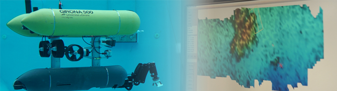
SIREC addresses these two needs through two independent but related use cases using the Girona 500 AUV. We anticipate that the algorithms developed will have applications in various scientific fields (biology, geology, environmental studies), and we will use them as a means of dissemination to the general public, as well as to explore ways to bring fieldwork and the seafloor into classrooms. These algorithms will be tested both in the water tank of the Underwater Robotics Centre (CIRS) and in extensive field trials. The trained algorithms will be optimised to run on the on-board hardware, thus enabling real-time execution to support the autonomous robot’s behaviour. During the project, comprehensive training data will be generated, and both the algorithms and the data will be made publicly available through online repositories.
GAME participation:
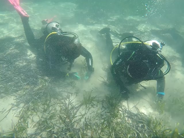
GAME will collaborate with the University of Girona by organising Groundtruthing field trips to confirm the match of the ‘visual decisions’ made by the robot and the real nature of the sea-bottom surveyed. Typologies of seafloor encompass meadow, dead mat, sand and rock.
Related news
Publications
Details
Reference: PID2020-116736RB-
Start date: 01/09/2021
Project members and collaborators
Rafael García (UdG)
Miguel Ángel Mateo Mínguez
Òscar Serrano
Participating and collaborating institutions
CSIC, Spain
VICOROB (Research Institute in Computer Vision and Robotics, UdG)